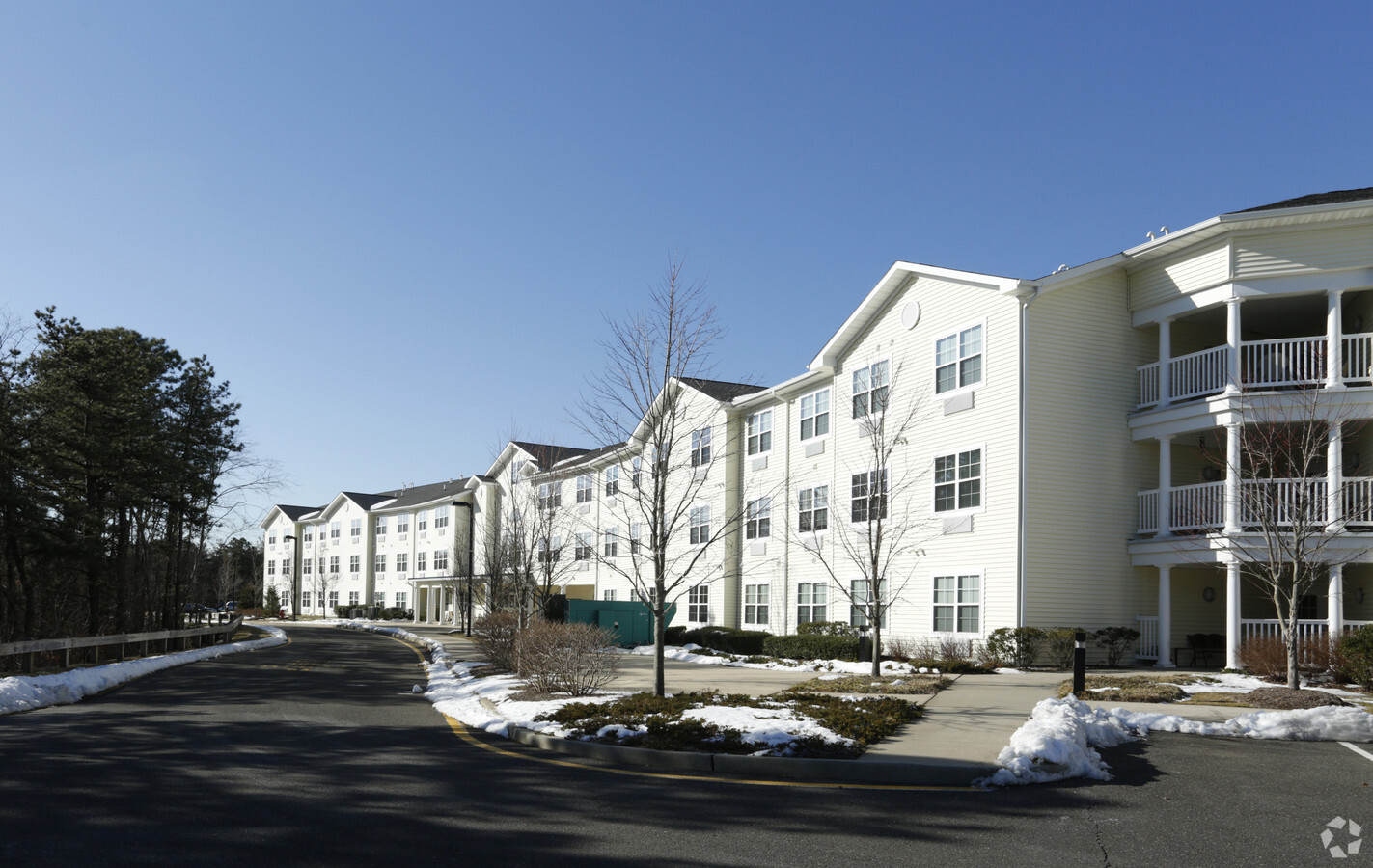
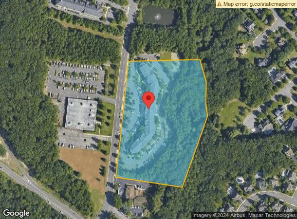
Property Record
25 Pine St, Tinton Falls, NJ 07753

NEARBY LISTINGS FOR SALE OR LEASE
-
-
View all Tinton Falls listings for sale on LoopNet.com
Property Detail
25 Pine St
New York-Jersey City-White Plains, NY-NJ
Senior Quarters/Tinton Falls-R
49-00123-0000-00049-05
FACILITY NAME: IN-LIEU TAX PAYMENT
Taxexempt
Monmouth
AE
New Jersey
34025C0327F
49.5
0
7.50 AC
2024
Tinton Falls
804802
Northern New Jersey
DEMOGRAPHICS near 25 Pine St
1 Mile
3 Mile
5 Mile
2024 Total Population
7,864
44,129
135,187
2029 Population
7,783
43,789
135,736
Pop Growth 2024-2029
(1.03%)
(0.77%)
+ 0.41%
Average Age
49
45
43
2024 Total Households
3,659
18,532
56,459
HH Growth 2024-2029
(1.89%)
(1.18%)
+ 0.29%
Median Household Inc
$90,879
$95,485
$90,463
Avg Household Size
2.10
2.30
2.30
2024 Avg HH Vehicles
2.00
2.00
2.00
Median Home Value
$385,636
$426,876
$482,029
Median Year Built
1993
1982
1971
Nearby Places
- Restaurants
- Banks
- Shops
- Fitness
- Groceries
PUBLIC TRANSPORTATION
COMMUTER RAIL
Asbury Park (North Jersey Coast Line - NJ Transit Commuter Rail (NJ Transit))
DRIVE
WALK
Distance
Asbury Park (North Jersey Coast Line - NJ Transit Commuter Rail (NJ Transit))
8 min
4.7 mi
Allenhurst (North Jersey Coast Line - NJ Transit Commuter Rail (NJ Transit))
DRIVE
WALK
Distance
Allenhurst (North Jersey Coast Line - NJ Transit Commuter Rail (NJ Transit))
9 min
5.4 mi
Freight Ports
New York Container Terminal
DRIVE
WALK
Distance
New York Container Terminal
50 min
38.6 mi
Nearby Properties
Address
Land Use
TOTAL SIZE
Lot Size
Zoning
Address
Land Use
TOTAL SIZE
Lot Size
Zoning
434,405 SF
52.92 AC
RT66
Address
Land Use
TOTAL SIZE
Lot Size
Zoning
4,289 SF
94.37 AC
CCRC
Address
Land Use
TOTAL SIZE
Lot Size
Zoning
1,153.70 AC
OSGS
Address
Land Use
TOTAL SIZE
Lot Size
Zoning
75.16 AC
R-7
Address
Land Use
TOTAL SIZE
Lot Size
Zoning
65,668 SF
111.60 AC
C50
Address
Land Use
TOTAL SIZE
Lot Size
Zoning
35.50 AC
R-7
Address
Land Use
TOTAL SIZE
Lot Size
Zoning
134,075 SF
339.89 AC
OSGS
Address
Land Use
TOTAL SIZE
Lot Size
Zoning
37.47 AC
AH
Address
Land Use
TOTAL SIZE
Lot Size
Zoning
32.19 AC
R-7
Address
Land Use
TOTAL SIZE
Lot Size
Zoning
25.37 AC
C-1
Address
Land Use
TOTAL SIZE
Lot Size
Zoning
153,160 SF
10.12 AC
BP2
Address
Land Use
TOTAL SIZE
Lot Size
Zoning
3,040 SF
194.08 AC
OSGS
Address
Land Use
TOTAL SIZE
Lot Size
Zoning
258,088 SF
27.90 AC
IO20
Address
Land Use
TOTAL SIZE
Lot Size
Zoning
201,455 SF
79.34 AC
R-1
Address
Land Use
TOTAL SIZE
Lot Size
Zoning
20.62 AC
AR3P
Address
Land Use
TOTAL SIZE
Lot Size
Zoning
181,064 SF
14.62 AC
IL
Address
Land Use
TOTAL SIZE
Lot Size
Zoning
224,683 SF
21.56 AC
CHS
Address
Land Use
TOTAL SIZE
Lot Size
Zoning
1,178 SF
21.78 AC
R-7
Address
Land Use
TOTAL SIZE
Lot Size
Zoning
5,407 SF
25.60 AC
C-3
Address
Land Use
TOTAL SIZE
Lot Size
Zoning
3,094 SF
277.60 AC
C
Address
Land Use
TOTAL SIZE
Lot Size
Zoning
132,378 SF
8.10 AC
OB01
Address
Land Use
TOTAL SIZE
Lot Size
Zoning
13,200 SF
18.63 AC
PUDR
Address
Land Use
TOTAL SIZE
Lot Size
Zoning
183,932 SF
23.51 AC
IL
Address
Land Use
TOTAL SIZE
Lot Size
Zoning
25,536 SF
21.95 AC
OR10
Address
Land Use
TOTAL SIZE
Lot Size
Zoning
15 AC
R-7
Address
Land Use
TOTAL SIZE
Lot Size
Zoning
34,590 SF
18.38 AC
C-2
Address
Land Use
TOTAL SIZE
Lot Size
Zoning
28,819 SF
13.59 AC
ES
Address
Land Use
TOTAL SIZE
Lot Size
Zoning
90,845 SF
23.24 AC
R-3P
Address
Land Use
TOTAL SIZE
Lot Size
Zoning
26,040 SF
6.88 AC
C-2
Address
Land Use
TOTAL SIZE
Lot Size
Zoning
332,213 SF
26.55 AC
OR10
The World's #1 Commercial Real Estate Marketplace
Connect with us
© 2025 CoStar Group
The information above has been obtained from sources believed reliable. While we do not doubt its accuracy we have not verified it and make no guarantee, warranty or representation about it. It is your responsibility to independently confirm its accuracy and completeness. Any projections, opinions, assumptions, or estimates used are for example only and do not represent the current or future performance of the property. The value of this transaction to you depends on tax and other factors which should be evaluated by your tax, financial, and legal advisors. You and your advisors should conduct a careful, independent investigation of the property to determine to your satisfaction the suitability of the property for your needs.